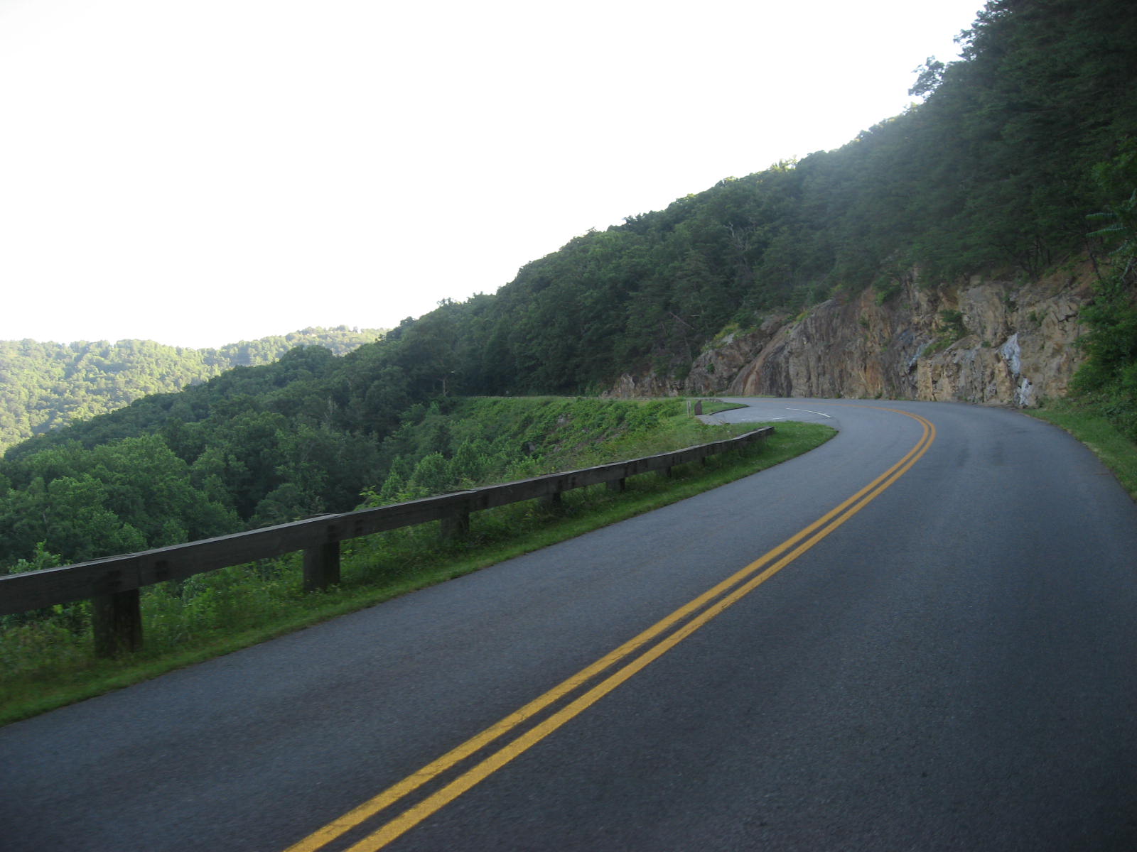
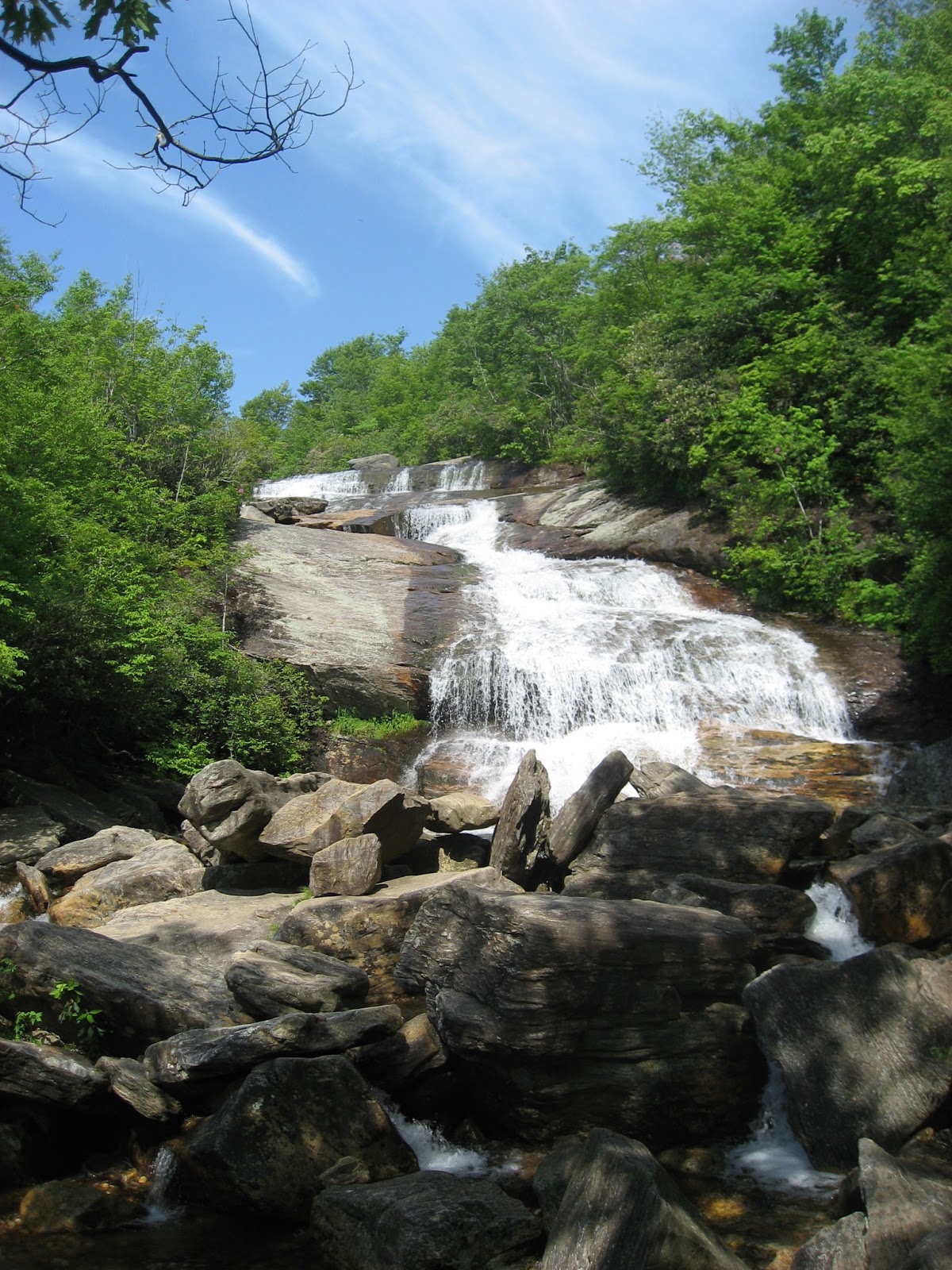
Last weekend, I had the choice to either go home for the weekend from Clarksville or go to Asheville. You ask, why Asheville. Well, one Asheville is known as Beer City USA. There are more breweries per capita than anywhere else in the US. Also, I've always wanted to go riding in mountains. Asheville is located just on the edge of the Appalachian Mountains. So, it was an easy choice to go to Asheville.
I decided at the last minute to go, so I had to find a hotel or a hostel. The hostels were all booked, so it was time to look for a hotel. I tried to priceline some really nice hotels and didn't find anything, but I did get a last minute deal that was 2 star hotel for $68. Hmm, should I choose it. I went ahead and took the risk. The hotel was the Ramada Inn on Pike Ridge. I read the reviews on Trip Advisor and found the reviews encouraging. I arrived around 5:00 and saw that they had a shuttle downtown which was the first good thing. Second, the room was good. It was simple room that I would barely see the whole weekend.
I took a quick shower and it was time to go downtown and explore. The shuttle from the hotel runs from 5 until 10:30, so knowing that I was going to ride in the morning the 10:30 time would be fine with me. I ended up tasting beers at Wicked Weed, Green Man, Asheville Brewing Company, and the Tasty Monk. All beers were very good.
The next morning it was time to ride up to Mt. Mitchell. This would be my first time to actually do a ride with a really long climb. The ride was going to be about 35 miles up hill and and 35 miles back downhill. The ride started at my hotel and went up the Blue Ridge Parkway. It was a beautiful ride up. I was able to wake up early enough to miss much of the traffic. The climb was long and I was ready to reach the summit and about 3.5 hrs later I was at the top! Now, it was time to go down. The downhill was the best part of the ride. I was ticking off the miles quickly and was back at my hotel an hour and half later!
After the ride, it was time for some lunch and hit the breweries up again. The beers today were from French Broad Brewery and some more around Asheville. It was another great night and day!
The next morning I planned on driving along the Blue Ridge Parkway to 441 which would take me over the Smokies. Along the way, I stopped and did some hikes and took some pictures. It was a beautiful day for driving and the hikes.
Let's see here, this race has come and gone. This was my first tri of 2013. It was on May 16th, so I'm not quite a month late with this report, but here it is!
Like most triathlon, your day starts early. I was up around 4:45 am and proceed to start with a little breakfast of a cliff bar and a banana. I washed it down with a gatorade on my down to Hot Springs Village. The drive was about an hour, so this allowed us to arrive around 6 am for the 7 am start! This would be the second year I've raced here. The course is a 500 yard swim, 13.5 mile bike, and 3.5 mile run. The event takes place in the largest gated community/city in the US. The roads are well maintained and traffic is at a minimum for this event. The only difference in the course this year was the run was taken off the golf course and would run through a neighborhood that runs along aside it.
I prepped my transition area like usual trying to keep things to a minimum since this was a sprint tri. I had one small bottle of water in my bottle holder which had a Nuun tablet in it. Other than that, no other nutrition would be needed. I set out my sunglasses, shoes, socks, helmet and I was ready to go! The weather for the day was starting off a little cool with temps in the mid 60s and cloudy. Once the race meeting was over, it was time to get a feel for the water. I knew the race would be wetsuit legal, but since it was only a 500 yard swim I decided I would do a warmup without the wetsuit and see from there. The water was around 72F and after a warmup swim I decided no wetsuit would be needed.
Swim
As with any triathlon swim start, this is the time I am most anxious. Also, this would be my first triathlon of t the year. There were about a 50 people lined up for the knee deep swim start. 5,4,3,2,1 Go, I'm off and swimming. Of course, no more than 75 yards into the swim, I start to feel uncomfortable and have to tell myself to relax and swim. I don't know what was in my head that day, but I never got comfortable with the swim. Well, I finally finish the swim in 11:24, and now it's off to the bike where I know I'm ready to ride! My swim was actually only 30 seconds slower than last year, even though I felt the swim took forever!
Bike
Now, it's my time to shine. I'm off on the ride. The course is a combination of numerous rollers with a couple of smaller climbs. The key to the course is to ride hard and fast. You need to have momentum to carry you over the rollers. This is a faster course than it appears. My only concern going into the bike this year was that I had not been doing many intervals so far. I've done a lot of zone 2 long rides. Moving through the bike, I could feel that my legs didn't like the pace I was pushing, but I was going to push on and ride hard. The ride went very smoothly. I came in feeling pretty good and ready for the run. My ride actually turned out 10 secs faster than last year. I was happy with that especially with very little interval/tempo work.
2013 - 40:26 Avg 20.0 mph 9/71 males
2012 - 40:36 Avg 20.0 mph 21/122 overall
Run
Last year, everyone came in talking about how hard the bike course may be, but left talking about the run course. The run course in 2012 was on the golf course, and a couple of climbs with some nasty little rollers that were some what steep. For 2013, the course was moved to the neighborhood along the course, so it would be interesting to see the change. I started out the run well. The first mile is overall down hill, but after hearing, some talk before the race, the next 1.5 miles would be the tough part. The course proceeds to go up hill followed by a flat and then uphill again, short flat, before finishing out heading back downhill. Throughout the run, I tried to keep my heart rate in check, fat chance, but continue to push. The last mile would end with an uphill towards the finish. I was able to push hard to finish and finished strongly. I was happy with run. The pace this year was much faster than last years.
Final Times
2013 - 1:21:07 - 3rd AG 30-34 - 12/71 males
2012 - 1:22:07 - 3rd AG 30-24 - 21/122 overall
Overall this was a good race to start the year with. I will have improvement on my swim and with more bike intervals, should be able to push the pace more on the shorter races. I was happy with my run. I'm happy with the PR for the race, and will be back again next year.
Here is the video of my 4th Dan Testing last Saturday. This was one more step on my journey with Grand Master Han's Marital arts. It has been a great 7 years, so far and hope that there are many more great years to come!
Last weekend, I rode in the Ouachita Challenge Tour. This ride is part of The Ouachita Challenge weekend. On Saturday, they have a 60 mile tour and Sunday is the 60 mile race. The route uses parts of the Womble Trail, Ouachita Trail, some gravel roads, and pavement.
I woke up around 3:30 on Saturday for the 2 hour drive out to start point at Oden, AR. The drive out there started out adventurous. When driving in the middle of nowhere at night, you have to keep your eyes out for deer in the middle of the road. I saw more deer on the road down there then cars!
I got to Oden around 7:00. I went and picked up my packet and found a couple of people that I knew. The race does offer a breakfast for free, but I ate along the way. The one thing that a lot of people do is that they sleep in the High School gym. I was told that it was part of the experience, hmm maybe next year.
After breakfast, I got everything ready and waited for the start!
Right at 8 it was go time! We rolled out along some asphalt roads and then hit the gravel about a two miles into the ride. The first 9 miles are asphalt and gravel. You start the climb into Big Brushy along the gravel roads and at 9 mile mark you hit the single track. The first part of Big Brushy is uphill and not that technical. The second half however, is a combination of some small climbs, rocks, roots, and just about anything the ride can throw at you. I'm not a very technical rider, so I ran into many spots where I had to get off the bike. However, it was because people were already off in front me. This helped take some of the pressure of because I didn't have to worry about being in someone's way.
Even though this a tour, you still have to make certain time cuts or you will be removed from the course. The time cuts work to where if you just barely make one, you probably won't make the next one. The first time cut was at Big Brushy aid station 15 miles. You had to be there by 11:00 am. I arrived to aid station filling pretty good about 9:50 am. The race has a cut off of 10:30. The aid stations were stocked with HEED, pickle juice, pickles, pb&j, and many other goodies. The one concern of mine was cramping, so I decided to hit the shots of pickle juice and headed on my way.
From Big Brushy, you get back on some single track for about 2 miles which most of it is climbing. You finally pop back out at the intersection of a gravel road or head towards Blowout Mountain. Because I was riding the tour, we skipped Blowout and would go around on gravel roads before the next section.
The next section is Chleybate Mountain. The only thing I knew about this section is that it goes uphill and when you think it's done it really gets steep. The description was correct. I was sure enough pushing my bike uphill for about 1/3 of this section. Overall this section wasn't to difficult, but the climbing was tough! Once you finish this section it's back on the road for about 10 miles heading towards the Womble Section.
At this point, I was just over 30 miles into in the ride in about 3.5 hours! I was feeling good and ready for the next section.
The Womble starts off with some great flowing single track. The trail is clear and flat in this section. You can sit back and enjoy the ride. I knew following this section was Mauldin Mountain. I had not gotten much description of Mauldin but I was ready to tackle it.
This section is constant climbing! You go up and when you think you can't go up anymore, you still go up! The climbs were not that steep, but they were relentless. You could get a short downhill, before finally going up again. You finally get a longer downhill before hitting another aid station. I was still feeling good here, but realized that it was still uphill! This is the Gaston Mountain section. I was feeling good for the first mile, but by the second mile frustration started to set in. In the uphills, were getting to me and by the time I got to the downhills I was clearly ready to be off the trail! We finally get to the last section where you ride on gravel roads for about a mile, get back on the Norfork Lake section of the trail and finally back to the last aid station.
The Norfork section was not very technical. It was smooth and flowy. Once you back on the gravel, it is time to head to the finish, but before you get there you are treated to one last climb! I was ready for this climb. I started slow and rode my way to the top.
I tried to smile for the camera at the top, but it appears that it didn't work out so well. I could call that a combination of pain face with an attempt at a smile! It was all smiles from the top. It was downhill for a bit and then back on the roads and back to the school.
There is a short climb for the finish which is a nice touch to end the day!
I was glad to have crossed the line 7 hrs and 30 minutes. I didn't get hurt, felt good throughout the race and had no major issues. I really enjoyed this race! The volunteers, the aid stations, and the feeling of the race was great. It is no wonder that this race sells out in 12 minutes.
During the ride, I was thinking I wouldn't do this again next year, but now a week later I kind of want to do the race next year. I would have to tackle Blowout Mountain and have stricter time cuts, but I feel I could be up for the challenge!
Below are some videos from Saturday and Sunday that give a feel for the race/tour!
I always enjoy looking at various destinations on the internet/books/magazines and find ideas for trips. Well this one trip that I would have never considered.
I have a couple of group travel sites that I like to explore time to time and see what trips are available and for the first time I saw the trip on Gap Adventuresfrom Lhasa to Kathmandu. Sounds simple right! Well this trip involves cycling from the start to the finish!
The trip is 23 days long and you get the chance to cycle over passes close to 16,000 ft on your way to Katmandu. You spend a day in Kathmandu before flying to Lhasa to spend 3 days getting used to altitude. Starting on Day 7, you begin your trip back to Kathmandu. Imagine spending your time cycling through some of the most remote regions of the world and seeing the highest peak in the world! This would be an amazing trip!
Looking at this trip cost here is a quick estimate.
Flight Little Rock to Kathmandu - $1892 - Not bad in my opinion
Trip Cost from Gap - $3699, includes most lodging and meals.
Bike - They recommend bring your own bike. No prices listed for rental. To fly with a bike overseas is probably another $400 RT.
Incidental Costs - $1000?
Here is the itinerary from the web Gap Adventure web page.
You may arrive at the joining-point hotel at any time
on Day 1 as no group activities are planned for today except for a
group meeting in the early evening followed by an optional dinner. It is
important that you arrive in time for this meeting as we will cover
important aspects of the trek. Please check the entrance of the hotel
for a notice from your CEO detailing the location of the meeting.
Day 2 Kathmandu
Today we have some time in Kathmandu as we need to
process our Chinese visas to get into Tibet. This means there is plenty
of time to wander around Kathmandu, where there is plenty to discover.
Lord
Pashupatinath Temple dating back to 400 AD is the Nepal's holiest Hindu
shrine. With its astonishing architectural beauty, it stands as a
symbol of faith, religion, culture and tradition. Thousands of pilgrims
from all over the world come to pay homage to this temple that is also
known as 'The Temple of Living Beings'. The richly ornamented pagoda
houses the sacred linga or phallic symbol of Lord Shiva. You can mingle
with the holy men or sadhus on the banks of Bagmati River, and see the
daily chores of Nepalese people paying their homage to Lord Shiva. Often
you can see the traditional cremation ceremony on the riverbank, which
occurs all through the day at the shrine.
On the other hand,
Boudhanath, is one of the world's largest stupas (Buddhist shrine).
Boudhanath (also called Bouddhanath, Bodhnath or Baudhanath or the Khasa
Chaitya) is one of the holiest Buddhist sites in Kathmandu, Nepal. The
Stupa is on the ancient trade route from Tibet which enters the
Kathmandu Valley by the village of Sankhu in the northeast corner,
passes by Bodhnath Stupa to the ancient and smaller stupa of Ca-bahi
(often called 'Little Bodhnath'). Join the pilgrims who gather to
circumnavigate the enormous dome, beneath the watchful eye of the Buddha
which gazes out from the gilded central tower. Join the pilgrims in
lighting butter lamps or candles on the shrines of the stupa, and send
the prayer wheels spinning their prayers up into the heavens.
Days 3-6 Lhasa
This historic city is situated in a small valley,
3700m above sea level. Lhasa rose to take an important role in the
administration of the country over 1300 years ago. At this time, the
grand temples of Ramoche and Jokhang were built to house the Buddha
images and religious artifacts brought into Tibet as dowries from China
and Nepal. Although little of the 7th-Century Lhasa survives, the
1600s saw a second stage of renovation and development, which included
the building of the Potala Palace (included in our tour). Perched on Red
Hill overlooking the town, this massive structure dominates the
landscape with grace and dignity - a true architectural wonder. The
Jokhang Temple is the spiritual heart of Tibet and also the most active.
Prostrating pilgrims circle the temple endlessly, day and night, some
of them traversing the extremes of the Tibetan landscape by foot to
celebrate and express their faith. Nearby are the huge monastic
universities of Drepung and Sera are still active institutions. We
will begin our time here with a tour of the Jokhang and make a kora
(circumambulation) of the Barkhor, the holiest devotional circuit, which
surrounds the Jokhang and houses a market bazaar where people bargain
for Buddha images, yak skulls with ruby eyes, woodcarvings, carpets,
prayer wheels and the odd goat's head.
Days 7-9 Yamdrok to Gyantse
The first day out of Lhasa is the first test of our
cycling skills, as we gradually begin our climb high up into the
Himalaya. Today is also our first camp – a good night’s sleep before
beginning the tough ascent of the Khamba La (4750m) – rewarded at the
top by spectacular views of Yamdrok Lake against a backdrop of
snow-topped Himalayan Peaks. Then it’s a winding descent to camp by the
lake (4420m). From here it is a stunning ride below the towering
glaciers of Mt Nojin Gangzang (7191m); alongside glacial streams, small
villages and across the Karo La (5045m).
Day 7 - Maximum Altitude: 3617m Sleeping Altitude: Around 3600 m Distance Cycling: 80 Kms
Day 8 - Maximum Altitude: 4807m Sleeping Altitude: Around 4300 m Distance Cycling: 75 Kms
Day 9 - Maximum Altitude: 5032m Sleeping Altitude: Around 4500 m Distance Cycling: 50 Kms
Day 10 Gyantse
Cross the Simi La (4330m), then it’s a relatively
gentle descent into Gyantse – in some seasons they valley floor is a
blaze of brilliant yellow rape flowers. In Gyantse and Shigatse we take a
break from camping to indulge in hot showers, beds and the local
restaurants.
Once of major importance as a wool trading centre on
the routes between India, Sikkim, Bhutan, Tibet and China, Gyantse
retain the feel of old Tibet. The imposing hill fortress, Gyantse Dzong,
dominates views of the town and is a great place for sunset views over
the town. In the morning of Day 10 we will visit Pelkor Chode Monastery,
founded in 1418, and the unique Gyantse Kumbum (meaning 100,000 images)
which forms a 3-dimensional mandala containing a seemingly endless
series of tiny chapels full of Buddhist images – Buddhas, demons,
protectors and saints.
Maximum Altitude: 4516m Sleeping Altitude: Around 4048 m Distance Cycling: 59 Kms
Days 11-12 Shigatse & Tashilunpo
It is a relatively easy ride to Shigatse, Tibet's
second-largest town, and the seat of the Panchen Lama who ranks second
in importance to the Dalai Lama. The huge complex of Tashilunpo is
visited daily by hundreds of devotees, armed with yak butter to feed the
lamps, who prostrate themselves around the stupas or walk up to the
chapel that houses the 26m-high, gold-plated statue of the future
Buddha. We will tour the monastery in the afternoon. Then perhaps join
the pilgrims on their evening kora (circumambulation) around the
perimeter of the monastery. Shigatse bazaar also buzzes with life.
Stalls, selling everything from slabs of yak butter to yak wool, prayer
wheels and rosaries, line the streets and Tibetans vie with each other
to win a sale. Be tempted by the antiques, jewelry and fur hats with
elaborate gold brocade designs or perhaps visit the carpet factory where
hand-woven carpets are made to traditional designs.
Day 11 - Maximum Altitude: 4048m Sleeping Altitude: Around 3852 m Distance Cycling: 90 Kms
Day 12 - Maximum Altitude: Around 4200m Sleeping Altitude: Around 4200 m Distance Cycling: 95 Kms
Days 13-14 Lhatse & Shegar
Back on the road, the route leads across the Yulung La (4950m) and the Gyatso La (5220m), the highest point of the ride.
Day 13 - Maximum Altitude: 4533m Sleeping Altitude: Around 4100 m Distance Cycling: 90 Kms
Day 14 - Maximum Altitude: 5253m Sleeping Altitude: Around 4408 m Distance Cycling: 65 Kms
Days 15-17 Rombuk & Everest Base Camp
Turn off the Friendship Highway for a stunning ride
through Qomolangma Nature Preserve to the top of the 5200m Pang-La
(pass) for a superb panoramic view from Manaklu to Shishapangma. Then
its a downhill stretch to Tashidzom. As you climb barley fields give way
to barren valleys of glacial debris. Finally reach the tiny Rombuk
Gompa at 5000m. The view from here is utterly spectacular! It is then 7
kilometers to Base Camp at 5200m.
Day 15 - Maximum Altitude: 5205m Sleeping Altitude: Around 4213 m Distance Cycling: 65 Kms
Day 16 - Maximum Altitude: 5009m Sleeping Altitude: Around 5000 m Distance Cycling: 35 Kms
Day 18 Lao Tingri
The route down from Rombuk is a rough, but scenic one. There are a couple of short, but steep descents. The guest house in Lao Tingri is basic, but hot showers are available.
Day 18 - Maximum Altitude: 5101m Sleeping Altitude: Around 4350 m Distance Cycling: 60 Kms
Days 19-20 Yarle Shung La & Nyalam
Back to the Friendship Highway where another two high
passes give a last, spectacular view of the Himalaya before leaving the
Tibetan Plateau - Lalung La (5124m) and the Yarle Shung La (5100m). Our last night in Tibet is at Nyalum – right on the edge of the Tibetan Plateau.
Day 19 - Maximum Altitude: 4563m Sleeping Altitude: Around 4500 m Distance Cycling: 75 Kms
Day 20 - Maximum Altitude: 5149m Sleeping Altitude: Around 3775 m Distance Cycling: 50 Kms
Day 21 Last Resort
From Nyalum the road descends sharply towards the
Nepal border, some 40kms and 2000 meters below. Moisture returns to the
air, the colors change, trees appear, lush green vegetation and the Bote
Khose river thunders below. After completing border formalities,
transferring luggage to the Nepalese vehicle and saying goodbye to our
Tibetan drivers and guides, it is a short ride down to the Last Resort, a
luxury tented camp and relax in the beautiful gardens, herbal steam
bath or plunge pool.
Day 21 - Maximum Altitude: 3776m Sleeping Altitude: Around 1065 m Distance Cycling: 80 Kms
Days 22-23 Kathmandu
The road continues its winding descent, hopefully
unhindered by landslides, towards Kathmandu. Rich in cultural and
artistic heritage blending the traditional and the modern, Kathmandu is a
vibrant, chaotic, colorful city - one not to be missed. You may depart at any time on Day 23